Search Inside This Blog

Showing posts with label hiking. Show all posts

Wednesday, 5 May 2021

How to hike or walk UCF trails (Bukit Persekutuan)

 Pulai Trail

The Urban Community Forest (UCF) is located within KL's Bukit Persekutuan (Federal Hill) and it has a number of trails suitable for outdoorsy people of all ages who are looking for a good dose of workout. Town folks need not travel far to immerse into forest bathing. UCF is a green network created by Malaysian Nature Society (MNS) in partnership with Think City.

There are five trails in UCF (refer map below):

  1. Jungle Fowl ('D')
  2. Pulai ('E')
  3. Cempedak ('I')
  4. Heritage ('L' - located inside MNS compound)
  5. Thunbergia ('L' - located inside MNS compound)
These trails are not grouped together in one forest patch and to hike them all will require walking on tarmac roads too i.e. the forest patches are not contiguous but are interconnected via roads.

Here's the guide to how to hike the trails (maximising the workout duration and distance) and where to safely park your vehicle and not disrupt the traffic flow. The total length of this leisure hike/walk distance is 4 km +/- and takes about 2 hours.

Saturday, 1 December 2018

Bukit Baginda - what's the speciality of this hill?


Bukit Baginda (local folks read 'Bagindo') basically has a number of boulders but only two with specific attractions - first with adventurous appeal and the other with photographic proposition.
My preference: Definitely the 'adventurous' boulder! Additionally, this boulder also offers photography opportunities all around 360 degrees, and top and bottom.

The final boulder, the "Wave Rock" (450 m asl) is not climbable without technical skills. It has the finest 'chiseled' rock wall unmatched by other boulders before this. At a glance, it looks like a clamshell.

It takes about an hour to reach the top and 20 minutes less on the descend trip. With photography build in, we took 2 hours just to get up and spent a good 45 minutes there before descending back to base (car park). We adjourned to Jeram Tengkek to wash up.

Some additional points:
  1. Mosquito - yes
  2. Leech - no
  3. Sandfly - no
  4. River crossing - none
  5. Any downhill climb? No - straight up after first boulder

Trip Photos

Trailhead cum car park
Quite a hefty sum just for this 2 km trip. See Facebook (< opens new window) for the write-up about the charges. 

Tuesday, 29 September 2015

Retracing Rhododendron Hill Peak & Trail No. 14


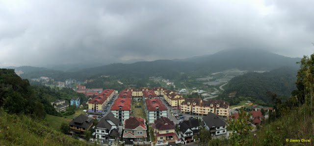
Viewpoint just above Puncak Arabella in Tanah Rata. Mount Berembun is on the right and whereas Mount Batu Brinchang is right ahead (11 o'clock direction) obscured by clouds.


Rhododendron Hill and Myrtle Hill were in my exploration plans since a few years back but never had the time to set foot on them. Until recently.

These two hills bear the old, colonial names during the days of late Sir William Cameron. Existingly, they are known as Bukit Mentigi and Bukit Kemunting respectively.  

The name "Rhododendron Hill" was noted in a local paper dated 12th May 1925. J.B. Scrivenor (Director of Geological Survey, FMS) stated "Rhododendron Hill", "Myrtle Hill", "Parit Falls" and "Robinson Falls" had survived, further quoting the latter was name in honour of H.C. Robinson whereas the rest were descriptive and apt. Apparently the name Myrtle Hill did not survive; and the name Bukit Kemunting is seldom used. 


On the larger map (10 in. = 1 mile), Scrivenor recognised that Myrtle Hill and Rhododendron Hill appeared as Bukit Kemunting and Bukit Mentigi respectively; he did not understood how "mentigi" appeared as a Malay name for Rhododendron; it was R.J. Wilkinson gave that Malay plant-name to represent rhododendron and whereas Kemunting was a literal translation. Mentigi in Bahasa Malaysia refers to a small plant.
 
Myrtle Hill (Bukit Kemunting) is located at coordinates N4.49129 E101.38444. The hill is located on the left side of the main road Jalan Pahang after the golf course but before reaching Brinchang town. It is the hill behind Parkland Apartment on its South-East with Strawberry Park Resort on its North-West. Jalan Kemunting is one of the roads branching off Jalan Pahang into Myrtle Hill. Since the hill is "well-developed" with private residences and resorts, I have not attempted to check out the hill. Moreover, there is no "tourist" forest trail to walk.

On the other hand, Rhododendron Hill, more widely known as Bukit Mentigi, has a peak with a viewpoint nearby and a couple of forest trails, namely Trail No. 13 and Trail No. 14.


Monday, 18 August 2014

Trail Formats

In trekking, there are generally 3 known route formats: (1) paper trail, (2) loop, and (3) trans.

In paper trail (originated from the idea of leaving bits of papers behind for others to follow), the start point is the same as end point e.g. G. Nuang via Pangsun -- you trek to and fro between the base in Pangsun and Nuang summit on the same trail (twice).

In loop (or circular), you do not trek on the same trail but still end at the starting point e.g. Puchong Hill enter Gate A, then exit Gate B and rejoins the common trail. Tabur West has the loop characteristic but not many are aware of it. Hiking G. Cantik and then heading back to MNS-BOH chalets via BOH Tea Centre back lane will encompass the use of both paper trail and loop formats.

The third format is perhaps the least understood route formats, and very often is incorrectly labeled in many outdoor events and postings. In trans (short for transverse), you traverse by enter at one point and exit at another point. Like loop format, you do not trek on the trail twice e.g. Trans Treacher's Hill (photo album at http://www.facebook.com/media/set/?set=a.10152486038623529.1073741930.645243528&type=3&l=e719785cd9). Trans has a major consideration -- transport logistics. You need to arrange driving so that you can get everyone back from end point back to starting point; alternatively have the belongings brought over to the ending point. A few famous trans treks include Tahan (Merapoh-Kuala Tahan), Irau-Yellow-Pass, V1 and even Apek-Saga trail in Cheras. Even Mount Kinabalu's Mesilau-Timpohon is technically a trans. 

Trans Treacher's Hill


Trans Klang Gates Quartz Ridge (East Ridge)
To comment, head over to original posting in FB: http://www.facebook.com/notes/jimmy-oddstuff/trail-formats/10152246088636434


Sunday, 25 May 2014

Long-deserted Bukit Permatang Kumbang

Trigonometrical Station
Trig station at the peak of Bukit Permatang Kumbang

It was a success solo search for this little-known small hill of about 180 metres in altitude. Initially with an on-and-off trail then complete absence of trail. An official map which I do not have but seen it states 577 feet.


An old photo from an online document


The nearby flat peak connects to a trail used by the HHH. Strangely, the trig station was not touched for years. Either the HHH folks know about this inconspicuous location and couldn't be bothered with it or they might not know it at all. I couldn't locate pics of this place on Google.

On 19th February 1989, a Flying Tiger B747 cargo aircraft crashed on the slopes of this peak. The bodies were successfully retrieved from the crash site. Today, according to the news (dated 2012), the remnants are no longer there as they were all picked up, especially by the nearby residents.

Sunday, 16 March 2014

A specific use of PVC bag for hikers and campers

Photo credit: Herbert Wong (photo source here)

The PVC bag like the one shown above has various uses. The intended purpose for the bags in this pic is for garbage collection by hikers. A strong point in using the PVC bag is its holding strength. Very few comes close to beating it. They can take on a heavy loads e.g. 25 kg, and higher. This is especially useful for the hiking community when garbage are collected; accidental dragging can happen when hiking over long distances and this is where it shows it power -- no tearing! This is totally unlike standard garbage bags from grocery stores; one has to wrap a second layer over it.

The additional weight compared to standard, or thicker garbage bag is really negligible. However, as for the price, it is more costly. Given the capacity, it would be a waste if the bag is not filled.

Another use for it, which is what I want to mention here, is for specific hiking purpose i.e. as a sitting mat or ground sheet. View the photos below for explanation.